Yellow Sea Region Greenfields Images
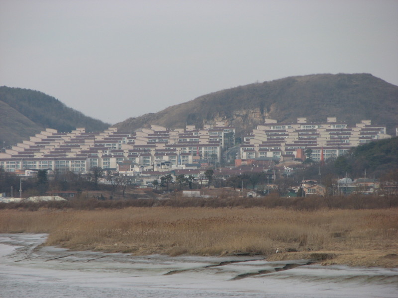
Photo 1. A hilly land greenfield site in the city of PaJu (파주시) province of GyeongGi (경기도), Republic of Korea. Newer residences were built on a terraced hillside, avoiding cropland and wetlands over which some of the residences have sweeping views. GokNeung Creek (곡릉천) is in the foreground. The line of darker brown vegetation behind the creek is a levee, which confines flood flows and protects cropland (not visible) between the levee and the buildings. The photo looks northwest. Behind the hills is the confluence of the Han River (한강) and ImJin River (임진강). (Photo taken 2008.12.13.)
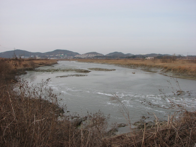
Photo 2. Wider-angle view of residences in Photo 1. Cranes constructing additional residences are visible to the left of the red-roofed residences shown in Photo 1. The line of utility poles on the left run along a road and levee (the line of darker brown vegetation). Another levee is visible on the right bank of the creek, along the line of utility poles. (Photo taken 2008.12.13.)
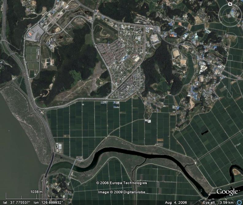
Photo 3. Aerial image of residences in Photo 1. The latitude and longitude shown is for the red-roofed residences, top-middle of photo. GokNeung Creek (곡릉천) flows into the Han River (한강) at lower left. This aerial image shows the three categories of greenfield construction sites defined for the proposed economic analysis: hilly land, cropland, and seashore areas (the Han River is brackish at this location). The roads on both sides of GokNeung Creek run atop levees protecting the cropland, built decades ago. They enclose freshwater and brackish wetlands on both banks. The bridge over GokNeung Creek in the lower-right corner runs beside a barrage (a dam). This is the location from where Photos 1 and 2 were taken. (Google Earth aerial photo date 2006.08.04.)
Photo 4. Levees and floodplain of ManGyeong River (만경강). Location: 35.903(6) degrees north latitude, 126.908(0) degrees east longitude, cities of GimJe and GunSan (김제시, 군산시), province of JeollaBuk (전라북도), Republic of Korea. Looking northwest. (Photo taken 2007.08.04.)
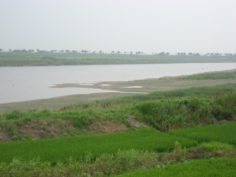
Photo 5. Levees and floodplain of ManGyeong River (만경강). Location: 35.9089 degrees north latitude, 126.8806 degrees east longitude, cities of GimJe and GunSan (김제시, 군산시), province of JeollaBuk (전라북도), Republic of Korea. Looking northeast. (Photo taken 2007.08.04.)
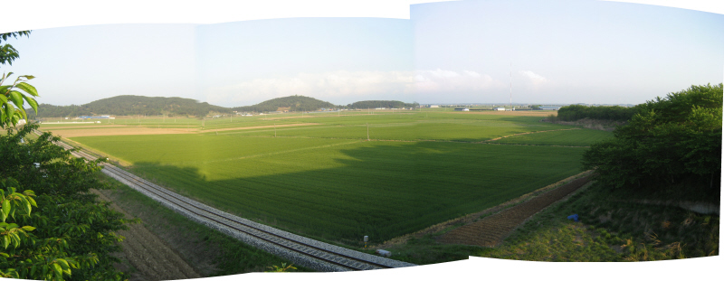 Photo 6. Cropland and low hills north of ManGyeong River (만경강). Location: 35.9492 degrees north latitude, 126.8347 degrees east longitude, city of GunSan (군산시), province of JeollaBuk (전라북도), Republic of Korea, north edge of Highway 26 and Expressway 15 interchange. Stitched-photo panorama looking northeast to southeast. (Photo taken 2009.05.03.)
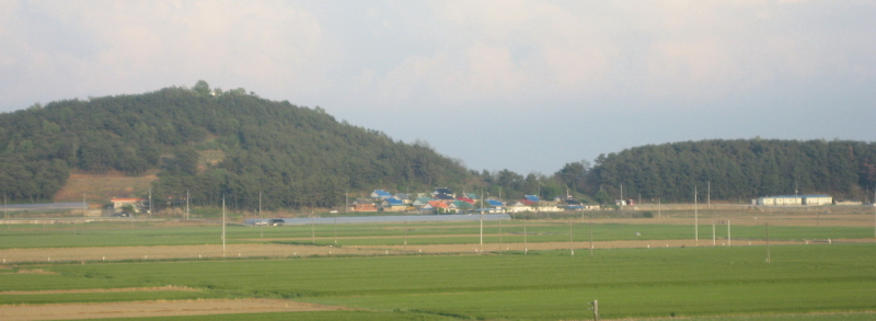 Photo 7. Hamlet nestled on edge of low hill. Same location and camera angle as Photo 6, a closer view. (Photo taken 2009.05.03.)
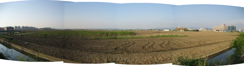 Photo 8. Cropland on northwest edge of JeonJu (전주), the provincial capital. Location: 35.8617 degrees north latitude, 127.0897 degrees east longitude, city of JeonJu (전주시), province of JeollaBuk (전라북도), Republic of Korea. Stitched-photo panorama looking north to east. (Photo taken 2009.05.03.)
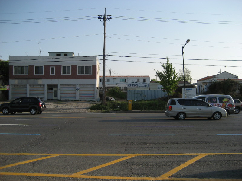
Photo 9. Buildings on northwest edge of JeonJu (전주), across the street from cropland in Photo 8. Looking southwest. (Photo taken 2009.05.03.)
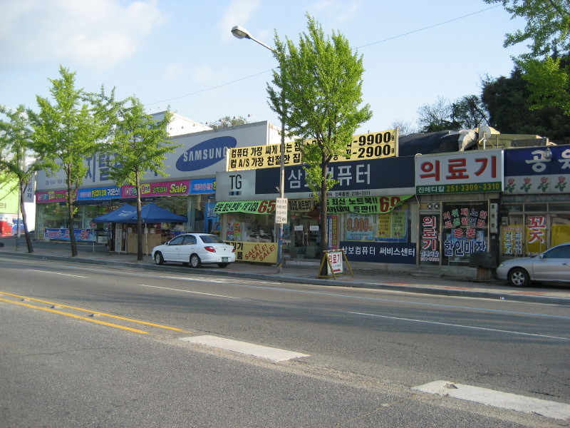
Photo 10. Single-story storefronts in JeonJu (전주). Location: a little southeast of Photo 8. Looking south. (Photo taken 2009.05.03.)
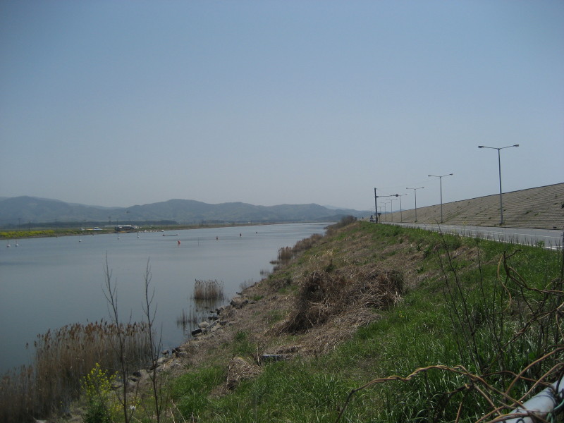
Photo 11. Boating recreation area landward of NamPo Seawall (남포방조제). Location: 36.2958 degrees north latitude, 126.5292 degrees east longitude, city of BoRyeong (보령시), province of ChungCheongNam (충청남도), Republic of Korea. Looking southeast. (Photo taken 2009.05.04.)
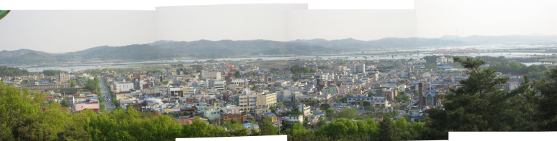 Photo 12. BuYeo (부여), Geum River (금강) floodplains, and nearby hills. Location: 36.28(8) degrees north latitude, 126.91(3) degrees east longitude, town of BuYeo (부여읍), province of ChungCheongNam (충청남도), Republic of Korea, taken from near BuSoSanSeong (부소산성), the hilltop fortress of the former BaekJe (백제) Kingdom capitol. Stitched-photo panorama looking south to southwest. (Photo taken 2009.05.04.)
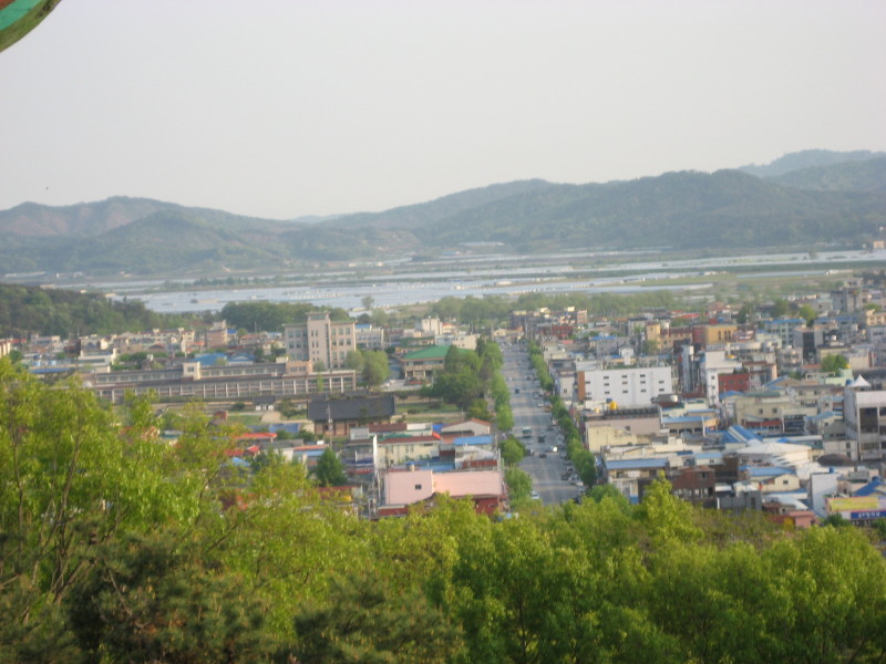
Photo 13. Leftmost (southward) photo of the panorama in Photo 12.